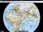
When I was a kid, maps were flat on the top of your desk. But in today’s world, students can see the world in 3D. One free app that engages students as they study their planet is called WhirlyGlobe. Students use their fingers to spin the globe; as they touch a certain spot, the name of the ocean or the continent appears first. If they land on Africa, for example, with just a touch of their finger, students can view an outline of the country as it looks from space. It does not take long for students to build Africa piece by piece with a few additional finger swipes. Our sixth graders have been studying Africa and have enjoyed this resource in their study of the Earth. The labels on this app allow them to see the size of these countries in perspective. As students swipe their finger across the iPad, they can make the map as big as they want.
 If you’d like your students to move beyond interacting with labels, Google Earth actually provides a unique street side perspective of any location on the globe. After downloading the app, students can type in an address on the search bar and immediately arrive at their location. Then, they can swipe the screen and drag the little orange man icon to get to a street view of anywhere in the world. It takes a little practice, but in no time at all, whole neighborhoods seem to come to life, offering students endless opportunities to virtually explore snapshots of the world in which they live.
 A third app, National Geographic World Atlas HD, costs $1.99, but is an easy way to plan a whole trip! With the touch of your finger, the globe spins, and with a swipe of your finger, the map becomes large enough to read. Students can show or hide pins on the map that mark specific locations along their trip and drag the tool at the bottom to calculate the exact mileage between two locations. There is also a currency calculator that helps convert US dollars to Yen, Euros, and British pounds. With a quick click, students can locate any country and have their money converted to estimate the costs of a trip to anywhere in the world.
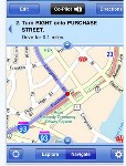
 AAA app is another great digital tool for exploring maps. This app allows students the opportunity to virtually explore their local community or plan a car trip around town. Hotels, restaurants, grocery stores, and pharmacies are easy to locate with this handy app. The map is in 3D, and you can track roads with a swipe of your finger. Welcome centers, gas stations, and rest areas are also part of the legend. This app gives travel directions from your current location to any address, city, state, or province. With a few clicks, students can create an itinerary with the locations they wish to visit and also generate directions to get their destination in the shortest amount of time.
In so many ways, geography comes to life with an iPad. With powerful apps such as these, students have a much more realistic view of the world and can play an active role in planning their own trips for fun or for real. An iPad seems to have become an important necessity for any road trip.
Marjie Podzielinski is the librarian at Coulson Tough School in The Woodlands, Texas.